
Walk a Mobile County Street
A reliable Mobile County street directory search moves from the physical address to the records that describe it. Ownership is public through the Revenue Commission roll and Probate Court instruments. Occupancy is harder. A homestead indicator can support owner occupancy, but it does not name each person in a home. Voter data and old directories add clues, yet neither is a complete census. Keep those distinctions in view from the first search.
- Enter the address in the Mobile County Revenue Commission Property Search. Save the situs address, owner, parcel or key number, neighborhood, mailing address, and exemption details that appear.
- Open the Revenue Commission interactive map from its official quick-links gateway. Find the same parcel, then click along the street and carry each parcel identifier back to the property search.
- Use the current owner in Mobile County Probate Court's Landmark index. Confirm the acquisition by matching its legal description, book and page, instrument number, or record date.
- For voter evidence, use an individualized My Voter Page search only for your own record. A broader geographic list must be ordered through the Secretary of State under Alabama law.
- For older occupants, consult Mobile Public Library directories and census material. When the address has changed, use the lot, block, subdivision, and deed chain as the stable bridge.
This sequence prevents a common error: calling every listed owner a resident. It also works when one portal fails. The parcel key connects the map to the tax card, while the legal description connects modern address labels to recorded land history.
Mobile County Street Search Fields
Mobile County's eSearch has more useful entry points than a simple street box. The Address mode supports a direct lookup, while Advanced mode can broaden a street directory search with property and neighborhood fields. When a full address returns nothing, search only the street name. That official portal tip can expose spelling, directional, or number differences without inventing a match.
| eSearch field | Input | Best street use |
|---|---|---|
| Street Number / Street Name | Text, optional | Use both for one parcel; street name alone for a broad browse |
| Owner Name | Text, optional | First or last name alone can broaden a follow-up |
| Key / Parcel / Owner ID | Text, optional | Carry an exact identifier from GIS into the tax roll |
| Property Type / Tax Year | Dropdown | Refine a large result set when useful |
| Neighborhood | Searchable selector | Compare parcels within an assessment neighborhood |
| Doing Business As | Text, optional | Check a nonpersonal ownership label |
The appraisal portal warns that its data is not for conveyance or legal use. Treat the parcel card as a route to the record, not the deed itself. Alabama assesses ownership on October 1, so a later sale may remain under the seller for that tax year, sometimes with the buyer shown “care of,” before the roll updates.
Note: A blank exact-address result may be a formatting problem, so retry with only the street name before leaving eSearch.
Mobile County Address Record Layers
No single Mobile County street record proves who lives in every home. Instead, each layer supplies a limited fact. The parcel number is the best shared key for tax and map work. A legal description, which identifies land by subdivision, lot and block or by measured boundaries, is stronger than a street label for deed research.
| Address source | Official keeper | Street evidence | Channel |
|---|---|---|---|
| Assessment | Revenue Commission | Tax owner, situs, mailing destination, parcel, value, exemption, neighborhood | Free eSearch; office help |
| Parcel GIS | County / Revenue | Footprint, adjacency, jurisdiction context | Free interactive map |
| Deeds and mortgages | Probate Recording and Records | Parties, transfer, book/page, instrument, date, legal description | Free registered index; paid images; Records Room |
| Plats and maps | Probate Court | Subdivision, lot, block, and geometry | Map books from 1872; online or Records Room |
| Permits and enforcement | City or county by jurisdiction | Work or reported property conditions | EnerGov, 311, counter, or records request |
| Voter list | Secretary of State / registrars | Lawfully released registration geography and address fields | Ordered list, with protected fields withheld |
A situs address is the parcel's physical location. The mailing address is where tax mail goes, and it may belong to an estate, business, representative, or owner who lives elsewhere. A plat is a recorded map of lots and streets. These terms explain why the same parcel can carry several address-like labels.
Mobile County Owners Versus Occupants
A property roll identifies owners, not all occupants. That is the central myth to discard before using a street directory. Renters, relatives, roommates, and recent movers may never appear on the assessment. Even the homestead field means the parcel met an owner-occupancy eligibility rule; it does not list the household. Recorded owner, taxpayer, occupant, and postal recipient can be four different people.
Corroborate rather than assume. Compare situs and mailing addresses. Check the deed date against the October 1 assessment cycle. Then use a voter record or a dated directory only for the narrow fact that source supports. An old city directory may associate a named householder with an address in its publication year, but it cannot establish current residence.
Insider tip. Keep a short source log with the record date beside each name. Mobile County address evidence becomes misleading when facts from different years are blended.
Map Mobile County Street Parcels
The county GIS hub links parcel, jurisdictional boundary, flood, facilities, representative, and polling-place maps. For street directory work, use the parcel map for approximate shape and adjacency. Zoom to the target, click a parcel, capture its key or parcel number, and repeat along the desired segment. Take those identifiers into eSearch for assessment facts.
Do not claim a radius or buffer search. The researched public interface supports spatial browsing, but its complete tool list, popup fields, export options, and update date were not verified. GIS is also not a survey. Boundary lines on screen help select the next parcel; recorded plats and legal descriptions control a title inquiry.
- Parcel
- A mapped unit of land used for assessment and record links.
- Situs address
- The physical address assigned to the property.
- Plat
- A recorded map showing a subdivision, lots, blocks, streets, or easements.
- Criss-cross directory
- A historical directory arranged by address or street rather than only by surname.
Mobile County Street Deed Chains
The Mobile County Probate Court has kept citizen records since the county's early years. Landmark searches recorded real-property material from 1813 to the present. The modern computer index covers 1984 forward, and stated document-image coverage begins in September 1995. A separate direct and reverse index covers 1813 through 1983. That depth makes a by-address inquiry much stronger when a present parcel must be tied to past owners.
Landmark requires free registration and email validation. Searches include name, document type, book and page, record date, instrument number, and legal description. Images cost $0.10 per page plus five percent, or are included in a $125 monthly high-volume plan; purchased images remain available for ten days. The index is a finding aid. When a historic courtesy image or online document is not enough, inspect the official record in the Records Room at 151 Government Street Annex, weekdays from 8 a.m. to 5 p.m., or call Records at 251-574-6070.
Landmark reports more than five million documents. For an entire subdivision, search a partial or full legal description and apply document or date filters. For one chain, identify the current owner's acquisition as grantee, then search that seller as an earlier grantee. Repeat while matching the same land description at every step.
Mobile County Street Permit Routes
Permits and code records split by jurisdiction. A postal address that says Mobile may sit inside the City of Mobile, another municipality, or unincorporated Mobile County. Verify the parcel on a jurisdiction map before choosing an office. The city permitting entry routes users to EnerGov, but the public search fields and coverage could not be verified because the application depends on JavaScript.
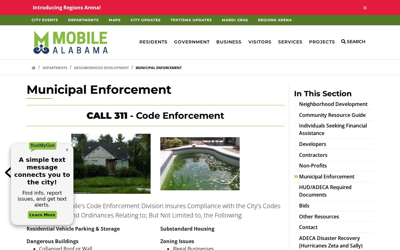
The City of Mobile permitting office is at 205 Government Street, third floor South Tower, and can be reached at 251-208-7421. Municipal Enforcement accepts 311 reports involving dangerous buildings, vegetation, minimum-property issues, refuse, zoning, unpermitted work, unsecured pools, vehicles, and obstructions. No open address-case index was found. Use the official Municipal Enforcement page, call 311, visit the counter, or submit a narrow city records request. Unincorporated building-permit questions route to 1110 North Schillinger Road, Suite 100, at 251-574-3507.
The Mobile Municipal Enforcement source explains which address conditions are handled through 311.
Mobile County Street Voter Evidence
Alabama's My Voter Page is an individual status tool, not a public street browser. After an identity match, it can confirm the querying voter's status, recorded address or district, polling place, and ballot status. Alabama does not register voters by party. For a broader geographic list, Ala. Code §17-4-38 governs an order from the Secretary of State. The request form permits county, city, or district scope and the office supplies a quote.
A released list may include name, residence or mailing address, status, registration geography, and participation history. Participation means whether a ballot was cast, never how anyone voted. Social Security numbers, license or ID details, full birth dates, and protected addresses are withheld. Suppressed records, inactive registrations, moves, and formatting gaps mean even a lawfully obtained list is not a full street census.
The Mobile County Board of Registrars is at 151 Government Street, Room 165, open weekdays from 8:30 a.m. to 4:30 p.m.; its phone is 251-574-8586. It handles registrations and corrections. Mail, in-person, and electronic updates are available. Absence or an address mismatch should lead to a correction inquiry, never a claim about the person.
Mobile County Historic Street Labels
Mobile's first city directory dates to 1837, but that early street grid is not today's grid. Numbering, growth, annexation, and changing postal labels can break a literal address search. The 2007 annexation added Mobile Terrace, Cadillac Park, and Airport/Schillinger areas, while later annexation material names Cottage Hill Corridor and Kings Branch/Orchard Estates. A ZIP or the word “Mobile” on mail does not prove municipal jurisdiction.
For historic occupants, Mobile Public Library keeps city directories dating back to 1837 as well as census, newspaper, burial, church, and local-history material. The full historical shelf belongs on the Mobile County city directories page. In an address chain, use those volumes to add occupants who may not have owned the parcel. If a number no longer matches, bridge through the subdivision, lot, block, deed parties, neighboring entries, and period maps rather than forcing the modern address backward.
Note: No verified countywide street-renumbering year or complete reverse-directory run was found, so confirm a needed volume with the library before travel.
Limits of Mobile County Street Records
A Mobile County street directory cannot supply a complete household roster. Utility customer data and motor-vehicle personal information are not public directory sources. Renters and family members may not appear on tax records. Alabama's Address Confidentiality Program and specific laws can shield qualifying addresses, while Probate Court redacts certain sensitive details and blocks categories such as living wills and military discharges except for eligible people.
Official sources also have normal gaps. A courtesy index is not the instrument. GIS shows approximate map context, not a survey. A permit portal may not expose a public search, and historical directories skip years. The sound fallback chain is the public counter or terminal, the office's record-specific form, a narrow Alabama Open Records Act request, and then the library or archives for pre-digital material. Missing online results do not prove that a record or resident never existed.
Lawful use. Use Mobile County street and address records for genealogy, property research, civic questions, and personal safety. Never use them to stalk, harass, intimidate, or harm anyone.